Multilateration
INVOLI Multilateration (MLAT) is an advanced server-based software that harnesses the full potential of any INVOLI receiver.
When it receives data from INVOLI receivers, it computes and confirms the location of aircraft transmitting signals over the 1090 MHz frequency. The Multilateration algorithm determines the aircraft's position by comparing the arrival times of identical messages at different receivers.
This method is particularly advantageous for determining the positions of aircraft that exclusively transmit Mode S and Mode A/C transponder messages, which do not provide positional data..

Take a moment to view a short video about Multilateration made by INVOLI:
Understanding the results of Multilateration is crucial, as they are influenced by several factors, including:
- The quantity of INVOLI receivers that capture the same signal (it's important to note that a weaker transponder may only transmit its signal effectively within a range of 10-20 km, whereas a stronger one can be detected from distances up to 400 km. This consideration is vital when determining the number and placement of G-1090 receivers)
- The aircraft's position in relation to the G-1090 receivers (the closer the aircraft is to the center of the G-1090 array, the more precise the results will be)
- The arrangement of the G-1090 network. Ideally, the G-1090 receivers should be positioned to form a “polygon,” as this configuration will yield the best Multilateration convergence within the enclosed area. A linear setup will not produce optimal results.

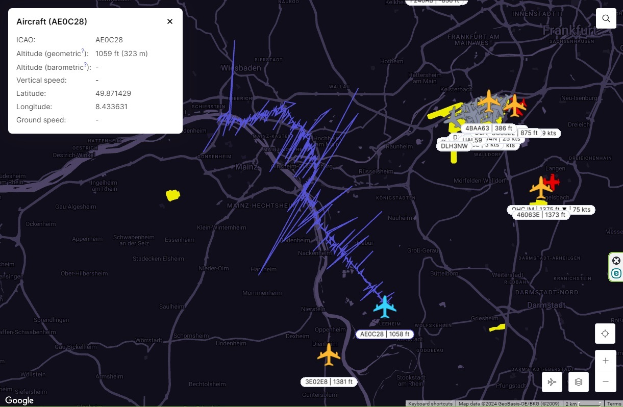
The image below illustrates the actual Multilateration track, highlighting the variations in position accuracy as the object progresses through an area where the multilateration coverage fluctuates from satisfactory to poor and then back to optimal.
Upon request, INVOLI offers a simulation of Multilateration coverage for your desired area, assisting you in selecting the optimal locations. Just complete this form to receive tailored guidance.
